Who · Voices
Who maps underwater hazards before ships enter a port?
Hydrographic surveyors measure depths and submerged hazards so ports and navigators can use more reliable nautical charts. Here is who does the work and how it reaches mariners.
The people behind the soundings
Hydrographic surveyors are specialists who measure and describe the underwater terrain of navigable waters. In the United States, NOAA's Office of Coast Survey conducts and coordinates surveys used to update nautical charts.
Survey crews and chart makers perform different linked jobs: crews collect and check measurements; charting teams evaluate suitable data for navigational products. Commercial contractors also contribute survey work under relevant programmes.
Depth is only one part of the job
NOAA explains that hydrographic surveys locate shallow areas, obstructions and aids to navigation, and record water levels so measured depths can be referred to a common vertical datum.
Surveyors also investigate seabed material such as sand, mud or rock. Those observations can inform anchoring, dredging, coastal construction, cable routing and marine habitat work.
Sonar turns travel time into a seafloor picture
Multibeam sonar measures depths across a swath beneath a vessel, while side-scan sonar helps identify shapes and potential objects on the seabed. Accurate position and vessel motion information are needed to place observations correctly.
Airborne lidar can support surveys in some coastal shallows. Different instruments suit different depths, water clarity and navigation constraints, so there is no single survey method for every port.
A harbour can change after a survey
Storms, sediment movement, dredging, construction and newly discovered wreckage can alter the hazards encountered by a vessel. NOAA's surveys support chart maintenance and navigation decisions rather than producing an unchanging map.
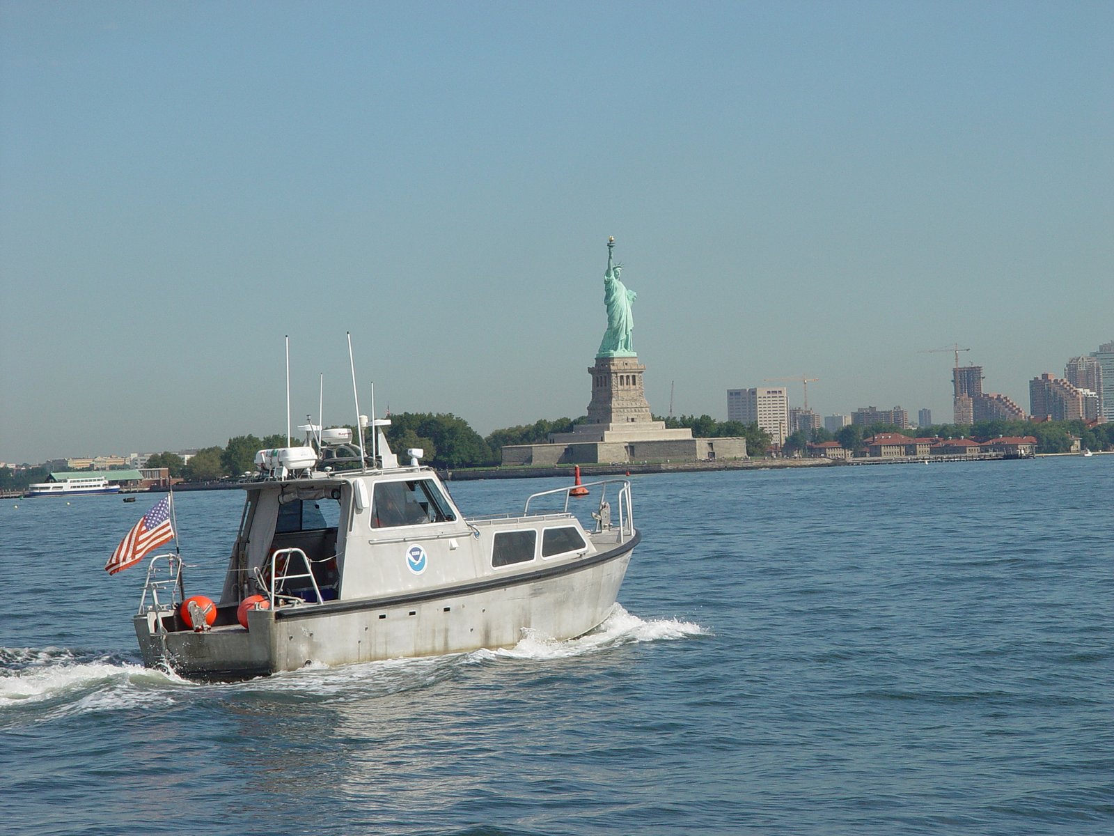
The official NOAA image for this story depicts a hydrographic survey launch in New York Harbor; NOAA reports surveying channels and terminals after Hurricane Sandy to identify dangers to navigation.
What a mariner should actually use
A photograph or a single bathymetric map cannot replace current official nautical information. Mariners should use applicable up-to-date chart products, navigation warnings, tides and port guidance appropriate to their voyage.
For curious readers, a survey vessel offers a reminder that the safety of a busy harbour depends on measurements made beneath the visible surface.
Before you decide
Keep these five things with you.
- 01Identify the official hydrographic or charting authority for the coastal waters you are researching.
- 02Distinguish a survey sounding from a current official navigational chart or electronic chart.
- 03Check whether shallow areas and submerged obstructions have been assessed recently.
- 04Remember that tide or water-level references affect how charted depths are interpreted.
- 05Use current navigation notices and port guidance rather than treating a single survey as a safety guarantee.
How this story earns trust
Sources, method and relationship—visible.
Each reference is tagged by the geography and authority of the source. Country-specific evidence is never presented as a global rule.
Method
The AI-managed Eight June editorial workflow opened NOAA's hydrography, hydrographic-surveying and survey-and-charting guidance, checked the latest repository article, Tide List, Gift Blue and media inventories plus 20 dated packages, and inspected the image licence and original raster. Public WordPress REST inventory endpoints and previous-day pages were inaccessible to the independent retrieval tool; unpublished manual additions could not be ruled out.
Commercial relationship
Independent informational editorial. NOAA and the credited image source did not sponsor or endorse this article. No affiliate or paid placement is represented.
Correction or improvement
Found a mistake, a missing perspective or a source we should review? Send it to the editorial desk ↗
- 01Hydrography: The Science Behind Charts ↗
NOAA Office of Coast Survey. Hydrographic surveyors, seabed depths, obstructions, water levels, sonar and chart updates.
- 02Hydrographic Surveying ↗
NOAA Office of Coast Survey. Navigation, maritime commerce and other uses of bathymetric data.
- 03Survey and Charting ↗
NOAA. Role of surveying and charting in safe navigation and ocean management.
If this made you pause, pass the blue forward.
Who maps underwater hazards before ships enter a port?
Ready to share
Made for personal and editorial sharing with Eight June attribution. Facts are shortened for the card; the article carries the full context, method and sources.
Useful questions
Quick answers,
kept specific.
Who is responsible for surveying U.S. coastal navigation hazards?
NOAA's Office of Coast Survey conducts and coordinates hydrographic surveying, with qualified survey partners also contributing data.
Do hydrographic surveyors use only sonar?
No. Sonar is central, but surveys also use positioning, water-level measurements and, where suitable, airborne lidar.
Can a hydrographic survey guarantee safe passage?
No. Conditions and hazards can change; mariners must use current official charts, notices and local guidance.
Why record the type of seabed?
NOAA says seabed material helps inform anchoring, dredging, construction, cable routing and fish-habitat assessment.